


Randomouss

gremmy76
User
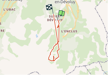

Length
13.2 km

Max alt
2087 m

Uphill gradient
768 m
Km-Effort
23 km

Min alt
1474 m

Downhill gradient
740 m
Boucle
No
Creation date :
2014-12-10 00:00:00.0
Updated on :
2014-12-10 00:00:00.0
7h13
Difficulty : Unknown

FREE GPS app for hiking
 SityTrail
IGN / Geographical institutes
SityTrail Plus
The world is yours!
About
Trail Walking of 13.2 km to be discovered at Provence-Alpes-Côte d'Azur, Hautes-Alpes, Le Dévoluy. This trail is proposed by gremmy76.
Description
Chemin majestueux vers le poc de bure. Assez difficile.
Positioning
Country:
France
Region :
Provence-Alpes-Côte d'Azur
Department/Province :
Hautes-Alpes
Municipality :
Le Dévoluy
Location:
Saint-Étienne-en-Dévoluy
Start:(Dec)
Start:(UTM)
732432 ; 4951034 (31T) N.
Comments